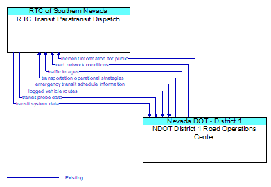
Interface: RTC Transit Paratransit Dispatch - NDOT District 1 Road Operations Center
Architecture Flow Definitions
emergency transit schedule information (Existing) Applicable ITS Standards
Information on transit schedule and service changes that adapt the service to better meet needs of responders and the general public in an emergency situation, including special service schedules supporting evacuation.
incident information for public (Existing) Applicable ITS Standards
Report of current desensitized incident information prepared for public dissemination.
logged vehicle routes (Existing) Applicable ITS Standards
Anticipated route information for guided vehicles, special vehicles (e.g., oversize vehicles) or groups of vehicles (e.g., governor's motorcade) that may require changes in traffic control strategy.
road network conditions (Existing) Applicable ITS Standards
Current and forecasted traffic information, road and weather conditions, and other road network status. Either raw data, processed data, or some combination of both may be provided by this flow. Information on diversions and alternate routes, closures, and special traffic restrictions (lane/shoulder use, weight restrictions, width restrictions, HOV requirements) in effect is included.
traffic images (Existing) Applicable ITS Standards
High fidelity, real–time traffic images suitable for surveillance monitoring by the operator or for use in machine vision applications. This flow includes the images and meta data that describes the images.
transit probe data (Existing) Applicable ITS Standards
Aggregate probe data derived from tracking transit vehicles. Data collected could include transit vehicle speeds and travel times for a given link or collection of links.
transit system data (Existing) Applicable ITS Standards
Current transit system operations information indicating current transit routes, the level of service on each route, and the progress of individual vehicles along their routes for use in forecasting demand and estimating current transportation network performance.
transportation operational strategies (Existing) Applicable ITS Standards
Operational strategies for each operating agency in a transportation corridor, downtown area, or other travel–impacted area, providing an integrated operations strategy for the freeways, tollways, arterials, transit services, parking facilities, and other transportation–related facilities in the area. These strategies can include dynamic adjustments to transit fares and tolls, parking fees and restrictions, dynamic lane restriction changes, and other active demand management strategies.