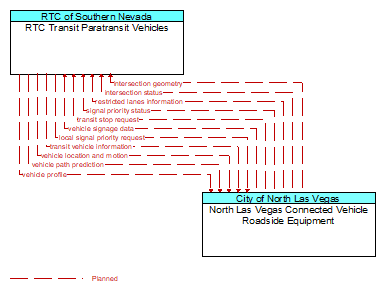
Interface: RTC Transit Paratransit Vehicles - North Las Vegas Connected Vehicle Roadside Equipment
Architecture Flow Definitions
intersection geometry (Planned) Applicable ITS Standards
The physical geometry of an intersection covering the location and width of each approaching lane, egress lane, and valid paths between approaches and egresses. This flow also defines the location of stop lines, cross walks, specific traffic law restrictions for the intersection (e.g., turning movement restrictions), and other elements that support calculation of a safe and legal vehicle path through the intersection.
intersection status (Planned) Applicable ITS Standards
Current signal phase and timing information for all lanes at a signalized intersection. This flow identifies active lanes and lanes that are being stopped and specifies the length of time that the current state will persist for each lane. It also identifies signal priority and preemption status and pedestrian crossing status information where applicable.
local signal priority request (Planned) Applicable ITS Standards
Request from a vehicle to a signalized intersection for priority at that intersection. This flow also allows the vehicle to cancel a priority request (for example, when the vehicle clears the intersection).
restricted lanes information (Planned) Applicable ITS Standards
This flow defines the location, duration, and operating parameters for lanes that are reserved for the exclusive use of certain types of vehicles (e.g., transit vehicles) or vehicles that meet other qualifications (e.g., number of occupants, low emissions criteria). It identifies the lane(s), the start and stop locations, start and end times, vehicle restrictions, speed limits and platooning parameters.
signal priority status (Planned) Applicable ITS Standards
In response to a request for signal priority, this flow indicates the status of the priority or preemption request.
transit stop request (Planned) Applicable ITS Standards
Notification that a transit stop has been requested by a transit user at a roadside stop. This flow identifies the route, stop, and the time of the request.
transit vehicle information (Planned) Applicable ITS Standards
Information about the transit vehicle route and stops, including current location along the route and next stop.
vehicle location and motion (Planned) Applicable ITS Standards
Data describing the vehicle's position, heading, speed, acceleration, transmission, steering wheel angle, braking status, size information, and trajectory.
vehicle path prediction (Planned) Applicable ITS Standards
The predicted future vehicle path of travel. This flow includes an indication of the future positions of the transmitting vehicle that can be used by receiving vehicles to support coordinated driving manuevers and enhance in–lane and out–of–lane threat classification.
vehicle profile (Planned) Applicable ITS Standards
Information about a vehicle such as vehicle make and model, fuel type, engine type, size and weight, vehicle performance and level of control automation, average emissions, average fuel consumption, passenger occupancy, or other data that can be used to classify vehicle eligibility for access to specific lanes, road segments, or regions or participation in cooperative vehicle control applications.
vehicle signage data (Planned) Applicable ITS Standards
In–vehicle signing data that augments regulatory, warning, and informational road signs and signals. The information provided would include static sign information (e.g., stop, curve warning, guide signs, service signs, and directional signs) and dynamic information (e.g., current signal states, grade crossing information, local traffic and road conditions, detours, advisories, and warnings).