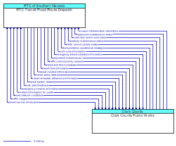
Interface: RTC Transit Fixed Route Dispatch - Clark County Public Works
Architecture Flow Definitions
current infrastructure restrictions (Existing) Applicable ITS Standards
Restrictions levied on transportation asset usage based on infrastructure design, surveys, tests, or analyses. This includes standard facility design height, width, and weight restrictions, special restrictions such as spring weight restrictions, and temporary facility restrictions that are imposed during maintenance and construction.
emergency transit schedule information (Existing) Applicable ITS Standards
Information on transit schedule and service changes that adapt the service to better meet needs of responders and the general public in an emergency situation, including special service schedules supporting evacuation.
emergency traveler information (Existing)
Public notification of an emergency such as a natural or man–made disaster, civil emergency, or child abduction. This flow also includes evacuation information including evacuation instructions, evacuation zones, recommended evacuation times, tailored evacuation routes and destinations, traffic and road conditions along the evacuation routes, traveler services and shelter information, and reentry times and instructions.
equipment maintenance request (Existing) Applicable ITS Standards
Identification of field equipment requiring repair and known information about the associated faults.
equipment maintenance status (Existing) Applicable ITS Standards
Current status of field equipment maintenance actions.
incident information for public (Existing)
Report of current desensitized incident information prepared for public dissemination.
maint and constr work plans (Existing) Applicable ITS Standards
Future construction and maintenance work schedules and activities including anticipated closures with anticipated impact to the roadway, alternate routes, anticipated delays, closure times, and durations.
road network conditions (Existing) Applicable ITS Standards
Current and forecasted traffic information, road and weather conditions, and other road network status. Either raw data, processed data, or some combination of both may be provided by this flow. Information on diversions and alternate routes, closures, and special traffic restrictions (lane/shoulder use, weight restrictions, width restrictions, HOV requirements) in effect is included.
roadway maintenance status (Existing) Applicable ITS Standards
Summary of maintenance fleet operations affecting the road network. This includes the status of winter maintenance (snow plow schedule and current status).
traffic control priority request (Existing) Applicable ITS Standards
Request for signal priority at one or more intersections along a particular route.
traffic control priority status (Existing) Applicable ITS Standards
Status of signal priority request functions at the roadside (e.g., enabled or disabled).
traffic images (Existing) Applicable ITS Standards
High fidelity, real–time traffic images suitable for surveillance monitoring by the operator or for use in machine vision applications. This flow includes the images and meta data that describes the images.
transit and fare schedules (Existing) Applicable ITS Standards
Transit service information including routes, schedules, and fare information.
transit fare information (Existing) Applicable ITS Standards
Information provided by transit management that supports fare payment transactions.
transit incident information (Existing) Applicable ITS Standards
Information on transit incidents that impact transit services for public dissemination.
transit probe data (Existing) Applicable ITS Standards
Aggregate probe data derived from tracking transit vehicles. Data collected could include transit vehicle speeds and travel times for a given link or collection of links.
transit schedule adherence information (Existing) Applicable ITS Standards
Dynamic transit schedule adherence and transit vehicle location information.
transit service information (Existing)
Transit service information including routes, schedules, and fare information as well as dynamic transit schedule adherence and transit vehicle location information.
transit system data (Existing) Applicable ITS Standards
Current transit system operations information indicating current transit routes, the level of service on each route, and the progress of individual vehicles along their routes for use in forecasting demand and estimating current transportation network performance.
transportation operational strategies (Existing) Applicable ITS Standards
Operational strategies for each operating agency in a transportation corridor, downtown area, or other travel–impacted area, providing an integrated operations strategy for the freeways, tollways, arterials, transit services, parking facilities, and other transportation–related facilities in the area. These strategies can include dynamic adjustments to transit fares and tolls, parking fees and restrictions, dynamic lane restriction changes, and other active demand management strategies.
work plan feedback (Existing) Applicable ITS Standards
Comments and suggested changes to proposed construction and maintenance work schedules and activities. This information influences work plan schedules so that they minimize impact to other system operations and the overall transportation system.
work zone information (Existing) Applicable ITS Standards
Summary of maintenance and construction work zone activities affecting the road network including the nature of the maintenance or construction activity, location, impact to the roadway, expected time(s) and duration of impact, anticipated delays, alternate routes, and suggested speed limits. This information may be augmented with images that provide a visual indication of current work zone status and traffic impacts.