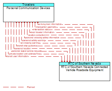
Interface: Personal Communication Devices - RTC of Southern Nevada Connected Vehicle Roadside Equipment
Architecture Flow Definitions
arriving train information (Planned) Applicable ITS Standards
Information for a train approaching a highway–rail intersection that may include direction and allow calculation of approximate arrival time and closure duration.
intersection geometry (Planned) Applicable ITS Standards
The physical geometry of an intersection covering the location and width of each approaching lane, egress lane, and valid paths between approaches and egresses. This flow also defines the location of stop lines, cross walks, specific traffic law restrictions for the intersection (e.g., turning movement restrictions), and other elements that support calculation of a safe and legal vehicle path through the intersection.
intersection status (Planned) Applicable ITS Standards
Current signal phase and timing information for all lanes at a signalized intersection. This flow identifies active lanes and lanes that are being stopped and specifies the length of time that the current state will persist for each lane. It also identifies signal priority and preemption status and pedestrian crossing status information where applicable.
local traveler information (Planned) Applicable ITS Standards
Traveler information including traffic, road, and weather conditions for a particular locality. This flow includes the location–specific traveler information and time effectivity of the information.
location correction (Planned) Applicable ITS Standards
Information provided to improve positional accuracy. These corrections allow a mobile GPS receiver, such as a GPS system in a connected vehicle, to achieve a
greater absolute positional accuracy, compensating for errors that exist in satellite positioning.
personal crossing safety information (Planned) Applicable ITS Standards
Current crossing status including permission to cross, crossing time remaining, and warnings in the event that a vehicle reports an imminent intersection infringement that may impact non–motorized users including pedestrians and cyclists.
personal location (Planned) Applicable ITS Standards
The current location (latitude, longitude, and elevation) reported by the personal information device
personal safety warning (Planned) Applicable ITS Standards
Safety alerts and warnings provided to a personal information device. The provided information would identify safety threats (e.g., vehicle encroachment into a work area, personal infringement into a travel lane)
personal signal service request (Planned) Applicable ITS Standards
A request for right of way from a personal device that indicates the type of traveler (pedestrian, special needs pedestrian, bicyclist, etc.), anticipated time of arrival, travel path, and crossing duration.
private location and address flow (Planned) Applicable ITS Standards
Any information flow between Vehicle/PID and Center or CCMS that the initiator needs to be kept private. Privacy in this sense means that the receiver does not receive the network address of the initiator, nor does it receive the geographic location of the initiator. Flows that depend on initiator geographic location cannot use this service.
rail crossing warning (Planned) Applicable ITS Standards
A warning of a train approaching or already in a highway rail intersection.
transit stop guidance (Planned) Applicable ITS Standards
Information sent from bus stop infrastructure to portable devices that includes stop–specific bus schedules and routes.
transit user information (Planned) Applicable ITS Standards
Information about individual transit users boarding a transit vehicle, used to track a user's progress on a scheduled transit trip.